 |
||
|
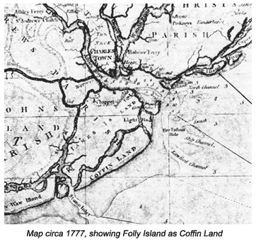
.....Much of what we know concerning the history of Folly Beach comes from its close geographic and cultural connections to the city of Charleston, South Carolina. The name "folly" is thought to have come from the Old English translation of the word, which means a clump of trees or a thicket. This name appears historically appropriate for the island. The main shipping channel into Charleston harbor in the 1700 and 1800's brought the ships past the northern side of Folly Island. For some ships, the trees on Folly Island may have been the first they had seen after a long voyage across the Atlantic. The island is also at times labeled Coffin Land or Coffin Island on some historical maps.
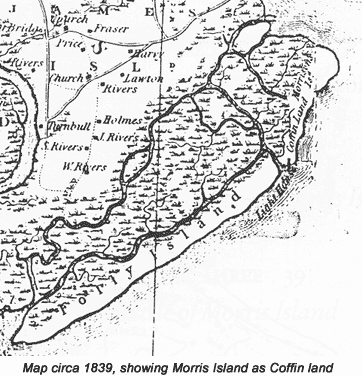
.....The significance of this name is still under debate for several reasons. Some believe that it is due to the fact that ships entering Charleston harbor would drop off sick and dying people on the island to avoid becoming quarantined. Others believe it came about from a shipwreck that occurred off the coast of Folly in 1700. This lead to many of the bodies of those onboard washing up on the beach. The final inconsistency with the name Coffin Island is that documents also show that name being used for Morris Island as early as 1749.
Morris Island was the
location of the Pest House in 1834. The Pest house was used to house
sick and contagious people entering the port of Charleston. Boats would
have to unload their sick passengers and crew before being allowed safe
passage into the harbor. The large number of sick and dying people on
this island may have lead to its naming. Mislabeling in maps is common
throughout history and occurs all over the world, the Iceland - Greenland
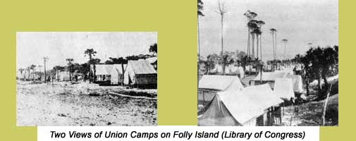
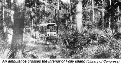
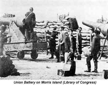
situation is a modern example. The island these troops occupied was very different from the island of today. At that time, Folly Island was relatively uninhabited. The first system of roads on the island was constructed by the federal troops to allow ambulances to transport wounded soldiers, and for communication purposes. The troops also constructed various forts
and batteries on both the northern and southern end of the island. A
large commissary depot, known as Pawnee Landing was built to aid in
the unloading of troops and supplies. The only actual fighting to occur
on Folly Island was on May 10th, 1863, when confederate forces attacked
federal pickets on the left side of Little Folly Island. The fighting
was light, as the confederate forces were conducting a reconnaissance
mission, aimed mostly at gathering information and taking prisoners.
The shelling began on August 17th, 1863, and quickly reduced Fort Sumter to rubble, but it was unable to force a confederate surrender. Folly Island, and Morris Island remained occupied by federal troops until the end of the war. |
||
 |