|
Return
to Multibeam Home Page
Gray's Reef Area
Gray's Reef is a National Marine Sanctuary located on the middle continental shelf
(~ 20 m water depth) off the coast of Georgia. The area consist of sandy bottom areas
and low-relief rocky ledges (i.e., hardbottom) that support abundant invertebrate
and fish communities. The 17 km2 sanctuary was mapped in
2000 (from aboard the NOAA
Ship
Whiting), and nearby hardground areas were surveyed in 2008 from aboard the NOAA Ship
Nancy Foster. College of Charleston students studied two of these nearby areas:
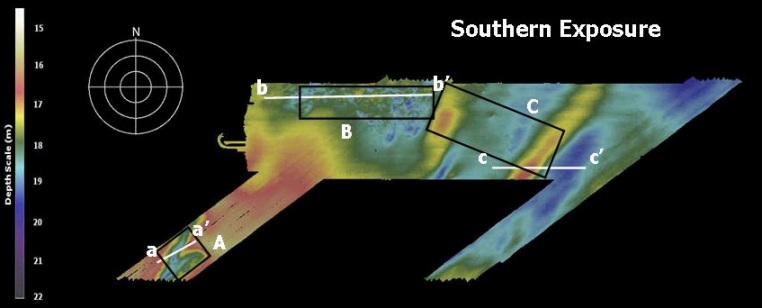
"Southern Exposure," an area immediately adjacent to the sanctuary, and
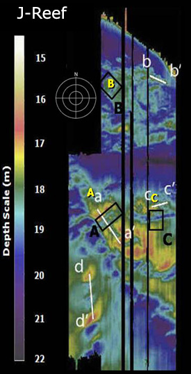
J-Reef, to the north northeast of Gray's Reef.
These images were created by Stephen Long and Christy Fandel (CofC Seafloor
Mapping Program). Data were provided by Greg McFall (GRNMS).
Location of J-Reef and "Southern Exposure" in relation
to Gray's Reef NMS,
on the Continental Shelf off Georgia.
Click on an area to view the multibeam maps, 2-D and 3-D images. 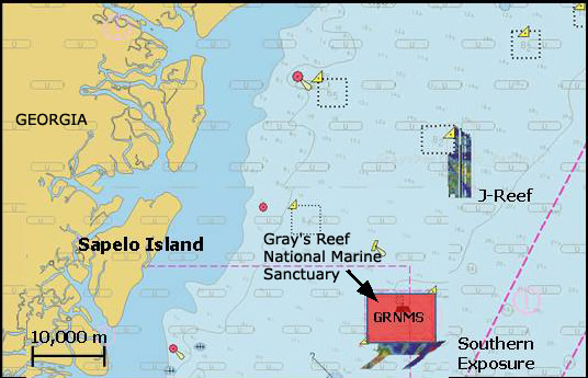
|