
Barrier Islands of South Carolina
Aerial Image Browser
(on-line version)
|
|
|||||||||
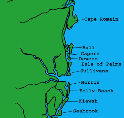
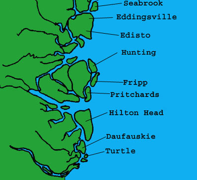
This aerial image browser is an online, interactive educational site, concentrated on presenting geologic and morphologic information about the 18 barrier islands of South Carolina.
Credits:
This site is an online version of the interactive CD, "Barrier Islands
of South Carolina", created by Dr. Mitchell Colgan and his undergraduate
students (Amer Smailbegovic, David Sansbury, Robin Humphries) at the Dept.
of Geology, College of Charleston. The technical aspects of the web-based
version were developed by Coastal Geology Online (CGO) staff, Mike Thomas
and Glenn vonRosenberg. Funding for the development of both the CD-ROM
and web site was supported by grants from the U.S.
Geological Survey's South Carolina Coastal Erosion Study.
This site is operated by Project Oceanica at the College of Charleston Department of Geology.
How to Use this Site:
Navigation through the site begins with choosing an island of interest
from the buttons on this page, or by selecting an island name on one of
the maps provided below.
Where possible we have kept the form of the information
intact.
Click here for a key
to air photo navigation tools
Pick an island and enjoy the journey,
The CGO Team of Project Oceanica
|
|
|
|
|