 |
|||||||||||||
|
Gray’s
Reef National Marine Sanctuary
Throughout our journey, May 11-21, each member from the following agencies and organizations plan to employ different instruments to collect data on the fish in GRNMS. These include scientists and divers from the National Oceanic and Atmospheric Administration (Mr. Greg McFall from Gray’s Reef National Marine Sanctuaries; Sarah Fangman from Channel Islands National Marine Sanctuary; Matt Kendall, Chris Jeffrey, Randy Clark, and Jenny Waddell from NOAA’s Biogeography Team); the S.C. Department of Natural Resources (Athan Barkoukis, Sarah Goldman); and the University of Georgia (Dr. Daniela Di Iorio and Katherine Doyle). Also accompanying us on this cruise are a scuba divers: Dave Grenda, representing REEF, and Kevin Grant who is a Sea Grant Fellow. The main purpose of this survey is to compare different traditional
fisheries assessment techniques used to determine fish abundance.
Fish traps, dives, and acoustic sensors will determine fish abundance
in GRNMS. Data collected during this survey will also be made available
to regional scientists as they develop hypotheses to address management
issues in our region. Additionally, opportunities to experience
our coastal “backyard” are made available to educators,
students, and scientists.
During the course of this cruise, scientists and divers will explore approximately 80 randomly selected sites that characterize one of the four habitats within GRNMS; these habitats are (1) ledge (2) sparse live bottom, (3) flat sand, or (4) rippled sand. Additionally, biotic and abiotic data found within the sanctuary will be collected. The biotic data include the percent cover of sponges, gorgonians, macroalgae, corals, and other sessile biota. The abiotic factors include the percent cover of sand, shell rubble, hard bottom, and fine sediments. Also, data will be collected on “marine debris”; this debris is defined as fishing gear, aluminum cans, and other man-made objects. It looks like we have an ambitious research program ahead of us. If this survey is similar to the events last year, then you will certainly want to check back with us every day. Feel free to email me any questions that you have about the research. My email is scientist10.nancy.foster@noaa.gov. Stay tuned; this is one trip you will not want to miss…
|
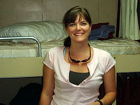 My
name is Elizabeth Rogers and I am your guide to this research expedition
in the Gray’s Reef National Marine Sanctuary, off of the coast
of Sapelo Island, Ga. This is my second trip to GRNMS on the Nancy
Foster and I'm tickled to be a part of this survey again. Over the
next nine days, I will serve as the ship-board marine science educator
and act as your portal to the research aboard our ship. I will give
you an idea for the kinds of research being conducted here in GRNMS,
as well as the myriad of techniques that scientists use to collect
data.
My
name is Elizabeth Rogers and I am your guide to this research expedition
in the Gray’s Reef National Marine Sanctuary, off of the coast
of Sapelo Island, Ga. This is my second trip to GRNMS on the Nancy
Foster and I'm tickled to be a part of this survey again. Over the
next nine days, I will serve as the ship-board marine science educator
and act as your portal to the research aboard our ship. I will give
you an idea for the kinds of research being conducted here in GRNMS,
as well as the myriad of techniques that scientists use to collect
data.
Publication of
Project Oceanica.
For questions or comments, e-mail Webmaster.