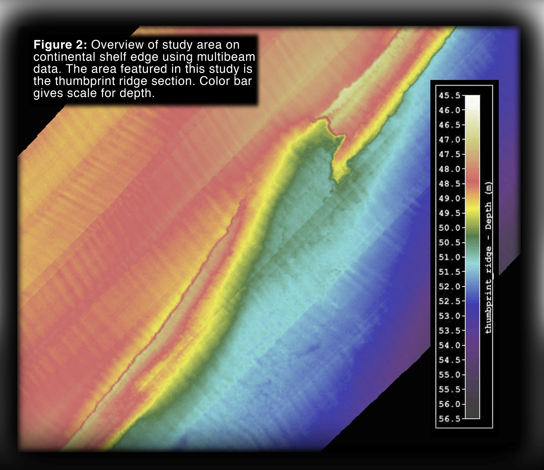
Map view of Thumbprint Ridge (North is at the top).
Triple Ledges | Crescent Ridge | Basemap
Scroll
down to review gallery images. |
Map view of Thumbprint Ridge (North is at the top).
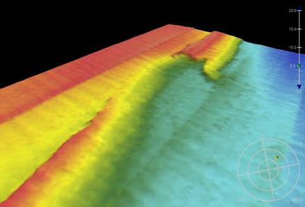
View of Thumbprint Ridge. looking north
(in the
general direction of the Gulf Stream current).
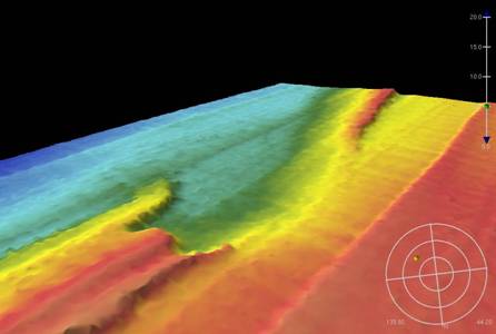
Thumbprint Ridge looking south (looking against the Gulf Stream).
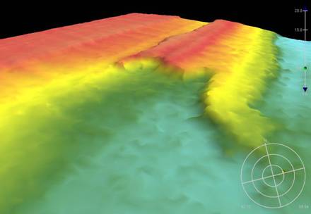
Close-up of Thumbprint Ridge.
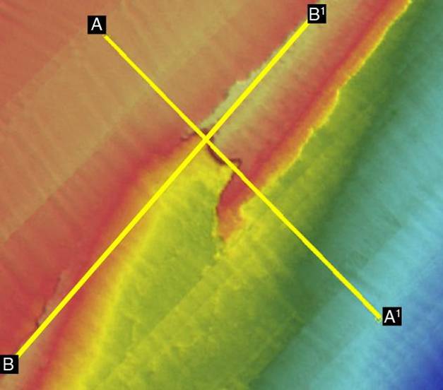
Locations of profiles, shown below.
A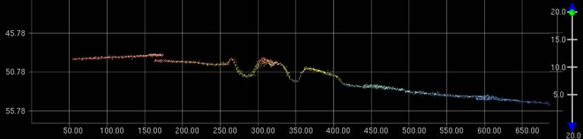 A1
A1
Profile A-A1(scale in meters), across Thumbprint Ridge.
B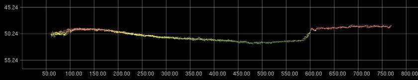 B1
B1
Profile B-B1 (scale in meters) along the trend of the shelf-edge region, across Thumbrint Ridge.