| Charleston
Gyre |

 |
 |
 |
| Daily At-Sea Logs- learn more about the Charleston Gyre mission from the research crew. |  |
| Ask the Researcher- questions from you on the land and the answers from the scientists at sea. | |
| PhotoDocumentaries- view first hand researchers and research techniques. | |
| Photo Gallery- Topic oriented Photo Galleries from the mission | |
| Career Profiles- meet the mission researchers. | |
| Meet the Crew- it is the crew of Oregon II that makes the mission possible. | |
| Video Gallery - view video clips taken during the mission of field work and life aboard a ship. | |
The January/February
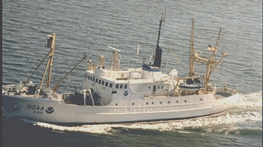
2003 cruise to the Charleston Gyre is the fourth Preliminary work indicates the swirling motion of the eddies that form off the Gulf Stream, brings nutrient-rich water from deep and off the shelf edge to near surface and results in enhanced primary production. Therefore, this may be an ideal place for juvenile fishes to feed as they grow. The reason for this mission is to assess production of the Charleston Gyre, its contribution to production of the entire southeastern Atlantic Bight, and its potential as pelagic spawning and nursery habitat for fishes.
|
 shelf”.
Researchers from the NOAA Center for Coastal Fisheries and Habitat Research
(Beaufort, NC) and Oceanica's Rachel McEvers sailed aboard
shelf”.
Researchers from the NOAA Center for Coastal Fisheries and Habitat Research
(Beaufort, NC) and Oceanica's Rachel McEvers sailed aboard 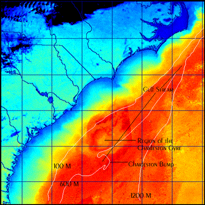
| Ph.
843-953-7263 |
Project
Oceanica Dept. of Geology & Environmental Geosciences College of Charleston Charleston, SC 29424 |
Fax
843-953-7850 |