Quadrant II
Harris Meander Area, Transect Meanders


Images produced by Christopher Stubbs, CofC Geology Major, Beam Team 2007

View Chris' research poster*:
"The Transect River Channel: Sonar and SCUBA Exploration of an Ancient River "
Stubbs, C., Sautter, L., Harris, M.S., 2007, Geological Society of America Abstracts with Programs, Vol. 39, No. 2

*at this time a full view of the Stubbs et al. poster is not available.

Quad I | Quad II | Quad III | Quad IV | Quad V | Basemap | Multibeam Home

Scroll down to review gallery images.


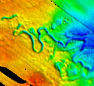
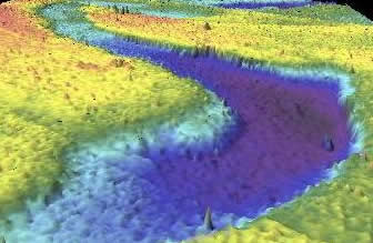
Quadrant II includes the Harris Meander, the original meander
mapped during Leg 02 of the Transect Program, using sidescan
sonar. Dr. Scott Harris was, at the time, a visiting faculty from
Coastal Carolina University. Dr. Harris is now on the College
of Charleston faculty
.

.........
View of the Harris Meander using an alternate depth scale color scheme.

TOP