Return to Multibeam Home Page

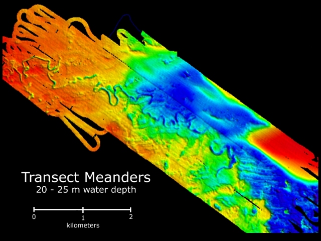
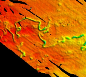
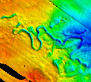
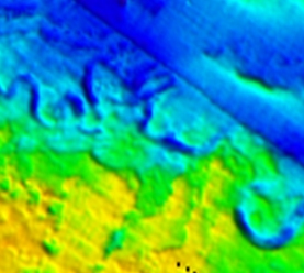
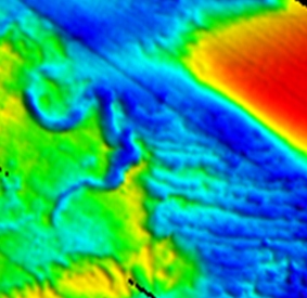
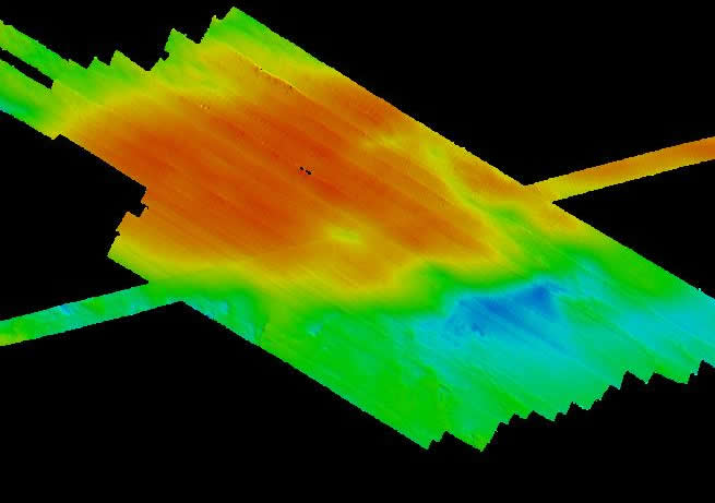
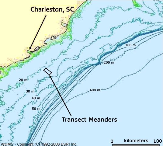
Transect Meanders

Located on the middle portion of the continental shelf off the coast of Charleston, the Transect Meanders were discovered using sidescan sonar in 2004 on Leg 02 of the Transect Program.
College of Charleston undergraduate students returned to the site in November 2006 and January 2008 to map the region using multibeam sonar from aboard the NOAA Ship Nancy Foster.


Click on an area of the basemap, below, or click on the thumbnail images
below the basemap to examine in detail the areas studied by CofC students. View location
.


basemapscale


Quadrant I
Northwest Area


1

Quadrant II
Harris Meander Area

Quadrant III
Central Area

Quadrant IV
Southeast Area
Quadrant V
Sand Ridge Area
quadIV Quad IV (not shown on basemap)
QuadV Quad V


Approximate Location of Transect Meanders
map

top

Publication of Project Oceanica, created by Leslie Sautter
as part of the
College of Charleston Transect Program's
Beam Teams 2007 and 2008


For questions or comments, e-mail Oceanica's webmaster.

Quad I Quad II Quad III Quad IV Quad V Quad I Quad II Quad III Quad V